Reconnecting the Emerald Necklace

Busy commuters making their connections at Forest Hills Station may not realize a vital connection has been created as well right outside the station. Our new placemaking graphic panels show how the most significant single entity of the Emerald Necklace, Franklin Park, has reclaimed its place as the pendant. The Necklace, a series of inter-connected urban greenspaces, was designed by the famous landscape architect Frederick Law Olmsted in the 1890s.
Community groups have been requesting the removal of the Monsignor William J. Casey Overpass since 2000. Opened around 1953, it was named for a popular local pastor who was in Jamaica Plain and West Roxbury from 1917 to 1949. The structure was declared structurally deficient in 2010; planning began in 2012, and the construction started in 2015. Even then, the project was not without its detractors who feared poor traffic flow through the area.
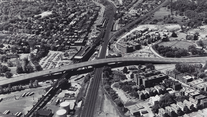
Designed and the implemented by HNTB’s Boston office, the new Casey Arborway Connector his a milestone in Boston’s urban traffic plan. This design is the result of numerous public meetings and a clear vision by the planning team. New public amenities; a new head house allowing commuters to pass under the Casey Arborway to the station; 500 new trees, wider sidewalks, new parking and interpretive kiosks for both history and wayfinding.
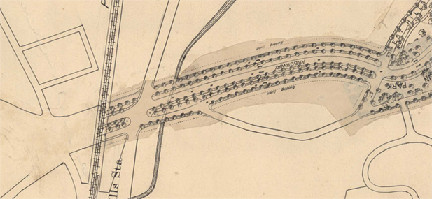
This location was a pathway for Massachusett, Nipmuck, and tribes long before English settlers colonized the area. The Stony Brook corridor connected the Shawmut Peninsula to destinations south, such as Narragansett Bay. The European colonists established a turnpike and then a railway from Boston to Providence, and Washington Street goes through here to the heart of Boston.
Content•Design was required to make two connections with our placemaking graphics program. First, the significance of reconnecting the Emerald Necklace and where you, the busy MBTA Orange-line commuter, are located on the Necklace. Second, describe the Southwest Corridor Park, a unique, five-mile-long park that took the place of the homes and businesses cleared for the Interstate 695 project. This project was halted through public protests leading to its cancellation in 1971 by Governor Sargent.
Panel 1: Olmsted and the Emerald Necklace
Not only does this panel depict the complete Necklace, but it also shows two other major greenspaces not part of the Necklace, hence three shades of green. This location is an incredible nexus with trains, trolleys, cars, and buses.
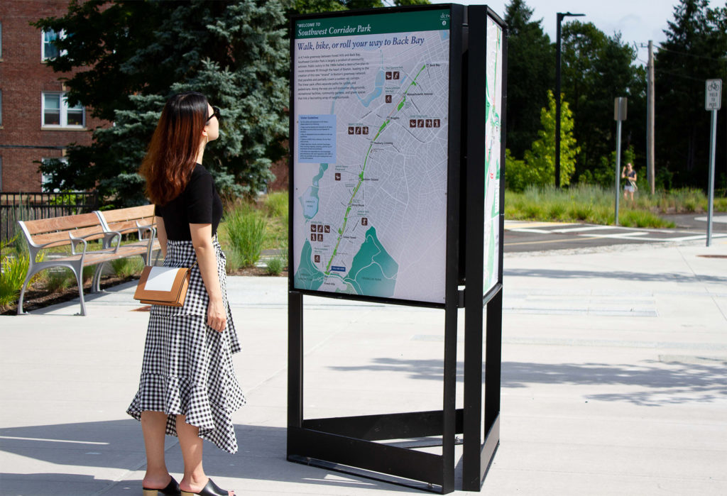
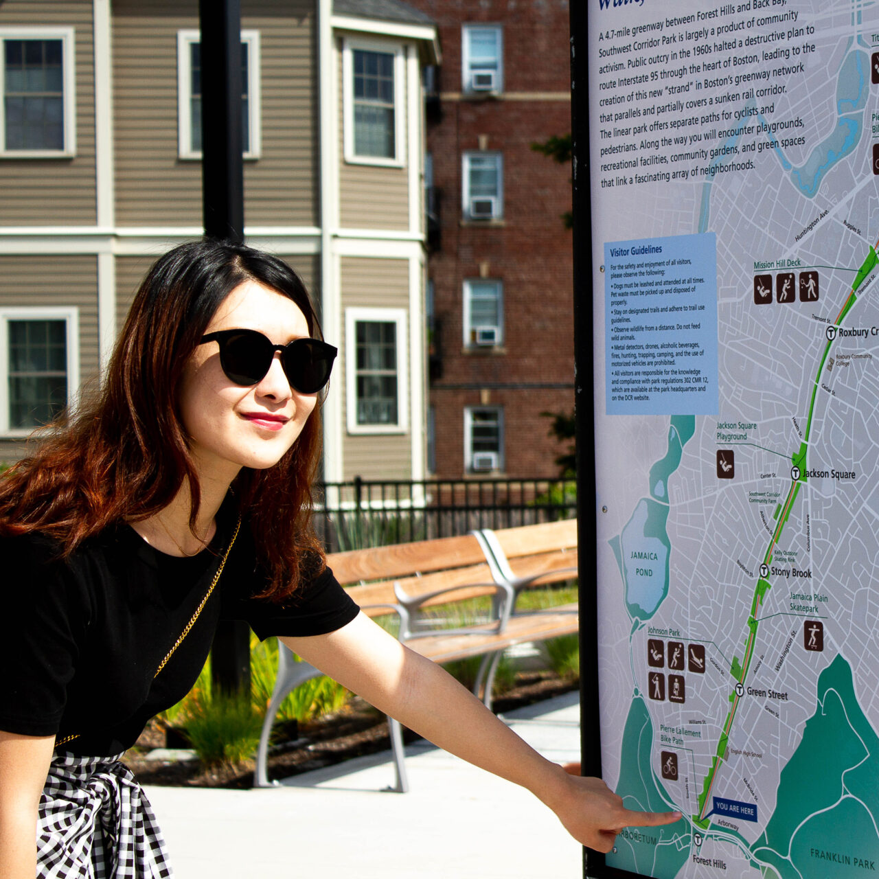
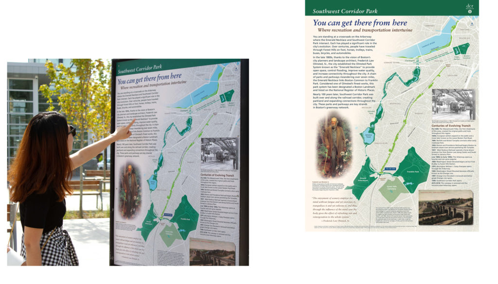
Panel 2: Southwest Corridor Park
This multi-use corridor will take you al the way to Copley Square. Along the way visit your friends in the South End, Roxbury, and Jamaica Plain. It is a multi-modal freeway for pedestrians, cyclists, skateboarders, strollers, and runners. This is the first comprehensive map of the Park ever created.
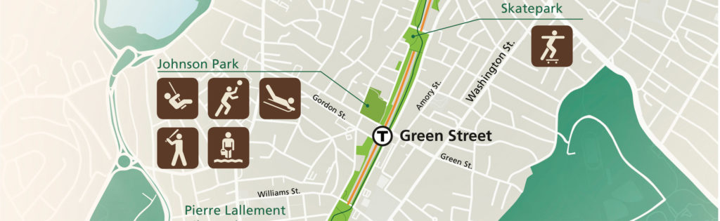
Creating the Southwest Corridor Park required our entire arsenal of pictographs to illustrate all of the activities available along the Park. The design of the panel shows the Park in relation to the Olmsted parks that surround it. Who is Pierre Lallement? The bike path is named after him, the inventor of the pedal bicycle.
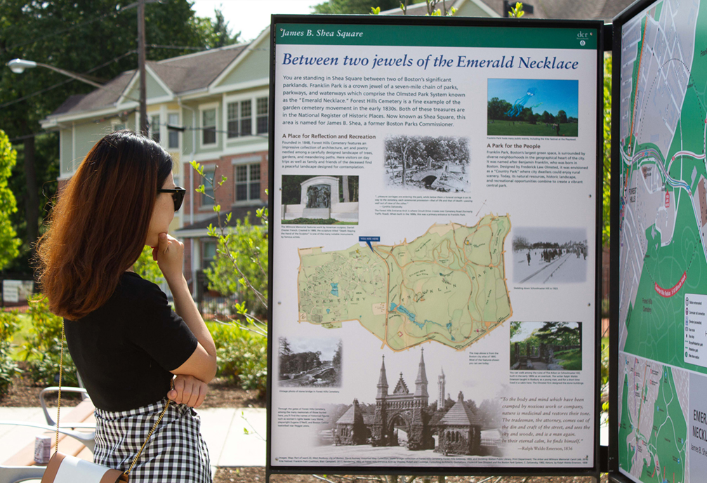
Panel 3: Shea Square
The third placemaking graphic is about Franklin Park and Forest Hills Cemetery. The Franklin Park Coalition provided a photo of the annual kite festival, illustrating how this “Country Park” was designed for city people by Olmsted. There are many fabled places in the Park, such as the Playstead and Schoolmasters Hill. The Cemetery is a different experience, full of winding paths and striking sculpture. It is on the National Register of Historic Places. Both destinations are but a short walk from Shea Square.
The project team consisted of MassDOT who provided much of the primary research, the Department of Conservation and Recreation who acted as the visitor advocate, as well as the Boston office of HNTB who not only provided excellent management but ice cream on Thursday meetings.