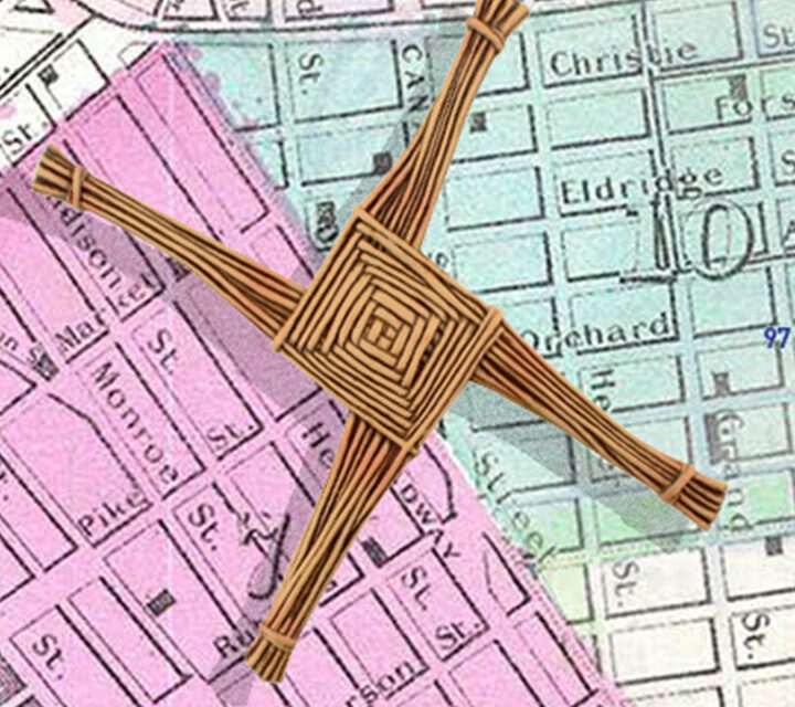
An Interpretive plan for gators, birds, hunters, and pythons
While obscured by the larger adjacent Everglades National Park in most people’s consciousness, Big Cypress has a claim to authenticity that its more popular neighbor park does not. Since its establishment in 1974 as the first National Preserve, traditional ways of hunting, fishing, and ethnobotany by the Miccosukee and Seminole nations have been protected. In addition, 300 privately owned camps remain in the Preserve. As a result, this alternative model to the typical National Park system has thrived. Regardless of human activity, thousands of species and ecosystems are present in the Preserve. Our new interpretive plan will ensure the success of this Preserve continues into the future.
Unfortunately, the wide variety of fauna includes the rogue Burmese Python. Since 1980 these constrictors, native to Southeast Asia, have ravaged the raccoon, opossum, rabbits and fox population. Except for the alligator, there are no native predators. Homo sapiens also pose a challenge; occasionally, inexperienced off-roaders need to be extricated from a wet trail. The Tamiami and Route 75 highways are a death trap for panthers and other creatures crossing them. Some animal passages beneath the roads, but foxes, turtles, and panthers do not read road signs. Perhaps in the far future, these asphalt tacts will be allowed to crumble back into the swamp while overhead, a Hyperloop tube will transport folks and material between Miami and Tampa.
Left, a Big Cypress trail in the wet season, wet walks are taken for granted. At right, the boardwalk at HP Willliams Roadside Park keeps you dry.
To help Big Cypress plan for the near future, the next ten years, the Park Service selected Goolrick Interpretive Group of Atlanta to lead the creation of a new Long-Range Interpretive Plan. Each park in the nation has one of these plans, and they are required to be updated every ten years. Content•Design was added to the team to meet the media plan requirement.
A Long-Range Interpretive Plan, or “Lirp” (if you are a ranger), involves a deep dive into the park mission and the current challenges. For example, is the Park winning or losing the challenges of nearby development, climate change or invasive species?
These trips always begin with a tour; our team is guided by the park staff. This is a treat in disguise; the academic staff knows their sites very well, and we treasure the insights shared with us. At Big Cypress, it was encountering the Immokalee Middle School students on a wet walk and learning about the former life of the Big Cypress Institute site. It was once a juvenile detention center, and there was an escape…to be continued. Faye and I noted all that we learned to include in the post-trip report documenting the eight stops on our first day.
The group photo at the end of the Recommendations Workshop.
The real work lies in the workshops, typically four to five sessions per day for three days over two trips. Faye Goolrick has led the workshops for over 25 reports. She is an expert at dramatizing the opening query for a session topic. Her professional and personal depth of experience ensures that a humorous and insightful anecdote delivered in her distinctive Atlanta voice will refocus the workshop participants when spirits are flagging, or participants are at cross-purposes. The breakout groups always generate lively discussions, and by the end of the day, post-it notes are scattered over the large notepad pages that cover one wall of the conference room/theater. Everything is captured and taken into consideration for the final report.
The best workshops have a broad constituency; our sessions were well-attended by staff, unfortunately, the only non-park entity was the Big Cypress Institute, which raises money for the Park by operating the gift shops and other programs. Perhaps there will be another occasion for the fan-boat tour operators and the swamp guides who take visitors on twilight kayak trips to add their voice. These residents of Everglades City and surrounding towns rely on the stewardship of Big Cypress for their livelihood.
Big Cypress has significant changes within the next two years that impact interpretation. For example, new infrastructure will improve cell reception, the western entry will be transformed with the removal of disused municipal offices on Preserve land, and the eastern entry visitor center (Oasis) is being demolished; what will replace it? The changes all have lasting impacts on visitor services, interpretation especially.
The foundations and recommendations work is complete, the implementation review will take place soon and by Independence Day, Big Cypress will have an interpretive plan to guide it through the next decade.
The original design of the Emerald Necklace was missing a link.
Busy commuters making their connections at Forest Hills Station may not realize a vital connection has been created as well right outside the station. Our new placemaking graphic panels show how the most significant single entity of the Emerald Necklace, Franklin Park, has reclaimed its place as the pendant. The Necklace, a series of inter-connected urban greenspaces, was designed by the famous landscape architect Frederick Law Olmsted in the 1890s.
Community groups have been requesting the removal of the Monsignor William J. Casey Overpass since 2000. Opened around 1953, it was named for a popular local pastor who was in Jamaica Plain and West Roxbury from 1917 to 1949. The structure was declared structurally deficient in 2010; planning began in 2012, and the construction started in 2015. Even then, the project was not without its detractors who feared poor traffic flow through the area.
The original Olmsted Arborway plan linking the Arboretum to Franklin Park
Aerial of Casey overpass shortly after completion in 1953-54.
Designed and the implemented by HNTB’s Boston office, the new Casey Arborway Connector his a milestone in Boston’s urban traffic plan. This design is the result of numerous public meetings and a clear vision by the planning team. New public amenities; a new head house allowing commuters to pass under the Casey Arborway to the station; 500 new trees, wider sidewalks, new parking and interpretive kiosks for both history and wayfinding.
This location was a pathway for Massachusett, Nipmuck, and tribes long before English settlers colonized the area. The Stony Brook corridor connected the Shawmut Peninsula to destinations south, such as Narragansett Bay. The European colonists established a turnpike and then a railway from Boston to Providence, and Washington Street goes through here to the heart of Boston.
Content•Design was required to make two connections with our placemaking graphics program. First, the significance of reconnecting the Emerald Necklace and where you, the busy MBTA Orange-line commuter, are located on the Necklace. Second, describe the Southwest Corridor Park, a unique, five-mile-long park that took the place of the homes and businesses cleared for the Interstate 695 project. This project was halted through public protests leading to its cancellation in 1971 by Governor Sargent.
Frederick Law Olmsted and his Emerald Necklace, once again whole, from Back Bay to Jamaica Plain.
Panel 1: Olmsted and the Emerald Necklace
Not only does this panel depict the complete Necklace, but it also shows two other major greenspaces not part of the Necklace, hence three shades of green. This location is an incredible nexus with trains, trolleys, cars, and buses.
Can I get to Copley Square from here? The start of the Southwest Corridor Park pathway.
Panel 2: Southwest Corridor Park
This multi-use corridor will take you al the way to Copley Square. Along the way visit your friends in the South End, Roxbury, and Jamaica Plain. It is a multi-modal freeway for pedestrians, cyclists, skateboarders, strollers, and runners. This is the first comprehensive map of the Park ever created.
Creating the Southwest Corridor Park required our entire arsenal of pictographs to illustrate all of the activities available along the Park. The design of the panel shows the Park in relation to the Olmsted parks that surround it. Who is Pierre Lallement? The bike path is named after him, the inventor of the pedal bicycle.
Considering the options at Shea Square.
Panel 3: Shea Square
The third placemaking graphic is about Franklin Park and Forest Hills Cemetery. The Franklin Park Coalition provided a photo of the annual kite festival, illustrating how this “Country Park” was designed for city people by Olmsted. There are many fabled places in the Park, such as the Playstead and Schoolmasters Hill. The Cemetery is a different experience, full of winding paths and striking sculpture. It is on the National Register of Historic Places. Both destinations are but a short walk from Shea Square.
Winner of a 2020 Boston Preservation Alliance Achievement Award
Roxbury, Massachusetts is 389 years old, and as a town, city, and now a neighborhood of Boston, has experienced all the significant upheavals and events of those last four (almost) centuries. Colonialism, war, slavery, immigration, the industrial revolution, civil rights, etc. all occurred after the Massachusett, Nipmuc, and other nations used this site long before William Pynchon and company established their church on a hill, the First Church in Roxbury in July 1632.
Content•Design Collaborative, along with Martha Lyons Landscape Architecture, Leonardi Aray Architects, Daphne Politis (Community Circle), Isabel Kaubisch (Clarendon Hill Consulting), and Karylin Crockett, were contracted in 2014 by the Department of Conservation and Recreation to create and implement a new Roxbury Heritage State Park. Located atop a puddingstone outcrop, the one-acre Park provides views to the city to the north, and South Boston and Dorchester to the east. The House, the oldest in Roxbury, offered 2,200 sf of exhibit space, that works out to a mere 600 square-feet per century.
Meetinghouse Hill, Roxbury, Massachusetts, 1799, John Ritto Penniman, Art Institute of Chicago
Art Inspiration At our first workshop with the Roxbury Historical Society, the Department of Conservation and Recreation project manager Patrice Kish unveiled a color print of this painting. It served as a touchstone for the course of the project. Research shows that Penniman created this painting as a welcome distraction from his day job; painting clock faces for his boss, Aaron Willard, of Roxbury Willard-clockmaking fame. His more-famous brother Simon’s clocks still tick in the United States Capitol and White House. The story goes that this painting was requested by Aaron to so his wife would not feel homesick after their move back to Grafton. When painted from Washington Street in Roxbury, clockmaking was the high-tech manufacturing of its day. The Willard shops relied on a network of 20 different businesses in a quarter mile radius. Their work presaged the industrial powerhouse Roxbury would become within the next 60 years.
A member of the Roxbury community takes note at the recommendations workshop.
Let the people speak Since the Department is responsible for the “health and happiness of people across Massachusetts,” our civics lesson began with a formidable series of public workshops and presentations. Event organizers Daphne Politis and Isabel Kaubisch expertly managed to set up three public review events during the winter and early spring of 2014. The public workshops made sure everyone was heard, for instance; one thorny issue was to have a fence or not around the site, a request was made for wifi on site, and the idea sounded that the site would act as a portal to other cultural sites in Roxbury.
The concept plan The scope of work included a formal interpretive report, facilitated and produced by Faye Goolrick with significant input from the Roxbury Historical Society and other local stakeholders. We completed a SWOT analysis and concept design and rolled it into a report in three months. Our interpretive criteria: It’s all about Roxbury, not Boston history, if it did not happen here in Roxbury it is not included in the exhibit, plus; focus on African American history. Our overarching theme; The hill on which stands the Dillaway-Thomas House was once the highest point at the nexus of a land bridge where once the people of the woodland passed on their way to the rich waters of the harbor. This house and site has survived intact for the entire course of US history and continues to thrive today as a vibrant, living, symbol of the enduring spirit of Roxbury.
With so much history to interpret and so little space, the development team proposed an epoch per room at the Dillaway-Thomas House. Visitors enter the House from the accessible annex, the first thing you encounter is a cavernous ten-foot wide cooking hearth, so we deemed this space the Parsons Kitchen, and it covered the pre-revolutionary war era. This gallery was followed by the Revolutionary War gallery, or the Thomas Gallery, for General Thomas who took residence there during the Siege of Boston. Next comes the Dillaway Room, named after Charles K. Dillaway, a scholar and early headmaster of Boston Latin. The next exhibit area is the Historic Hallway and the 20th Century Roxbury Room. Upstairs the House featured a gallery loosely dedicated to 21st Century Roxbury accompanied the multi-purpose changeable art gallery and community meeting space.
The initial content plans for the House and annex.
This Old House Considered a historic site because of its role in the Revolutionary War, the House had a cast plaque fastened to it after the Dillaway family’s 67-year residence. After a decade of neglect, it was restored by local historic house pioneer, Frank Chouteau Brown. He added some fanciful colonial restoration elements along with the current mix of federal and latent Georgian details. It was completed in time for a grand dedication for the George Washington Bicentennial in 1932, because he visited, (though did not sleep) the House during the Siege. Looking healthy in the 1940s, the House again fell into neglect and was almost burned down in an arson attempt in 1979 when Boston was known as the arson capital of the world.
A beautiful postcard created shortly after the Dillaway family was gone, 80 years later after an arson attack.
The House was practically empty at the start of the project; it served as much as a meeting place for the community as a place of interpretation. Glass panel labels overlaid exposed sheathing and joists to provide a remodeling history of the House. Otherwise, a rare framed handbill or photo propped on the mantle referred to Roxbury’s history. The Roxbury Historical Society, incorporated in 1901, used the House as its headquarters.
The Colonial Kitchen Amos Adams, the Harvard-educated pastor, preached at the First Church in Roxbury across the street. He went through two wives, Elizabeth, and Abigail, and was survived by his third, Sarah, with a total of eight-plus children between them. We interpret the lives of these hard-working colonial ladies with a fully-featured hearth, hearth table with inlaid graphics, and interactive cupboards. On the doors of the cupboards, which may be original to the 1755 house, are prompts, Who lived here with Amos Adams? And What did they own? Open the door, and the cupboard is stocked with the answers.
Home is where the hearth is, on the right the cupboards are full of surprises.
On the hearth table, a cookbook contains everyone’s favorite colonial recipes such as Bird’s nest Pudding or Dressed Macaroni.
Slavery and Dissent in Roxbury There is no evidence of slaves at the House, but plenty on the existence of slavery in Roxbury. Several major streets, such as Ruggles Street, are named after slaveholders. The Roxbury Historical Society identified a 1771 tax inventory of Roxbury, it showed that there were 362 citizens and 21 “servants for life.” The exhibit features a bill of sale of a negro man by the name of Boston and a broadside lamenting the lack of oversight of negro servants,
A portion of the graphic panel about slavery in Roxbury.
Amos Adams, the pastor who lived in the House before the Revolutionary War was a patriot. He urged the citizens of Roxbury to produce goods of their own rather than import them from England. To set an example, in 1768, Elizabeth Adams, the pastor’s wife, organized a spinning bee in which 60 women gathered at the House and spun “one hundred score of linen yard.” Apparently, there were many approving onlookers.
Boston Besieged and the General With all hell breaking loose in the spring of 1775, the leaders of the colonial rebels appointed veteran John Thomas as a leader of the militia tasked with keeping the British troops in Boston. Roxbury stood on one side of the only ground route called Boston Neck. Our exhibit features a letter from the collection of the Massachusetts Historical Society where General Benjamin Lincoln informs Amos Adams that “It would be quite agreeable for General Thomas to remove into your house…”. Other experiences are a recreation of General Thomas’s field desk where you can hear a dramatic reading of one of his many letters to his wife and an interactive map placing the House in context of the siege of 1775-76.
The Dillaway-Thomas House was at the center of action during the 1775 Siege of Boston, map courtesy of the Boston Public Library.
While General John Thomas looks on, an audio program plays back a reading of a letter he wrote to his wife during the seige of Dorchester.
Roxbury Transformed, the Dillaway Room The map of 1832 Roxbury shows long country roads lined with occasional dwellings, with a dense cluster around the First Church in Roxbury. There are rolling hills on the unoccupied spaces, most likely used for farmland. Just 58 years later little of this open space remained, Roxbury was a dense as any other neighborhood in Boston, though West Roxbury remained suburban. In our small gallery, we focused on the lively domestic environment that was the Dillaway family, with over ten family members and domestic staff living there at any one time it is a wonder that Charles Dillaway had room to run his school for girls. Mr. Dillaway was former headmaster at Boston Latin, an author, and participated in the first Japanese student exchange program. Fragments of a 19th century Satsuma vase were found on the site, perhaps a gift from the students?
The advanced organizer, aka introductory graphic panel, to the Victorian era, at the right, evidence of industry and workers in Roxbury; a child’s shoe, stove part, and horse blinder.
In an excerpt from Roxbury Magazine in 1899, found by our team writer and researcher Carrie Brown, a former student described Dillaway’s classroom atmosphere as being “sunny and loving.” It went on to say “At recess we walked in the garden at the back of the house or were allowed to go into the parlor and play the piano,” hence the reproduction Chickering piano in our exhibit. The Victorian-style center table is where an interactive foosball exhibit challenges visitors to assemble various maps of Roxbury correctly.
Chickering pianos were popular around the time the quote from the Roxbury Magazine was written. The picture on the right features Mr. Dillaway with the Japanese students he was hosting. The fragments of a 19th century Satstuma vase found on site are featured in the case on the piano.Our Victorian center table features a foosball game approach to understanding the changing maps of Roxbury. Over the mantle is a reproduction of a chromolithographic print the nearby Louis Prang factory was famous for.
Historic Hallway The entry and center staircase is the one portion of the House least affected by Chouteaus imaginative restoration or 1979 fire. The elegantly spaced stairway rises much more relaxed than your typical short tread, steep-pitched New England farmhouse stair. We feature a Willard-style longcase clock, and the framed Penniman painting, a reproduction, of course, a permanent loan from the Art Institute of Chicago could not be arranged.
The central stairway stayed intact through renovations and fire, the Penniman painting is featured here. At the landing the view to Eliot Square and the First Church in Roxbury are interpreted.
New Voices, the 20th Century The population changed in size and shape in Roxbury in significant ways. Brahmins like Mr. Dillaway gave way to Irishmen, who in turn rubbed shoulders with Italian, Latvian, Jewish, and German immigrants. After the Second World War, the great migration enlarged the existing African American population to a near majority, filling in when the last significant subgroup, the Jewish community, departed for the suburbs in the 1970s. Today Roxbury is the nexus not only to African American culture but Caribbean and African people. An audio station, paired with a flip book, has the voices and stories of prominent community leaders such as Michael Haynes and Melnea Cass, graphic panels feature the art of John Wilson and a photograph of Martin Luther King Jr. leading his first march outside of the south from Roxbury. The featured painting over the mantle is a work by Alan Crite, an artist who featured Roxbury and South-end neighborhoods in his work.
The sunlight creates a glow on the arts and crafts style pattern on the glass panel.An audio program features civic leaders interviewed for the exhibit. On the right, artifacts from the LIttle-Collins House, the Roxbury home where Malcom X spent his teenage years.
Roxbury Today The most popular exhibit concept presented during the community meetings was the gestural touch-exhibit that would show the changes to the Roxbury area through the ages, from Nipmuc settlement to metropolis. With the talents of Northern Light Production, this digital pipe-dream became a reality. Over 62 feature locations across eight moments in history makes this exhibit the star of the show for all ages.
This gestural touch table shows the changing landscape of Roxbury from mudflats to metropolis. It was a highly anticipated exhibit that was proposed for the last public forum and was heartily endorsed by the community.
There was one other requirement from the Roxbury Historical Society—all maps of Roxbury must show the 1868 borders when Roxbury was annexed to Boston. The boundaries you see on your smartphone reflect the Boston Redevelopment Authority’s idea on what constitutes the neighborhood of Roxbury. My mother grew up on Mission Hill and considered her Irish immigrant community to be part of Roxbury, now considered a separate area altogether by the city of Boston. When the historic boundaries of Roxbury are overlaid on the map of the city today cultural institutions such as the Museum of Fine Arts and Northeastern University as well as the entirety of the Longwood Medical District are all part of what Roxbury offers the city.
many institutions would be surprised to learn they are part of historic Roxbury, the Longwood Medical area for one, the Museum of Fine Arts for another.
The Park The landscape designer had two elements on site to build on. First, a puddingstone wall, a local conglomerate from which many Boston edifices are constructed. There was an active Roxbury quarry on Parker’s Hill for decades. Plus, the existing apple trees from the historic orchard that produced the Roxbury Russet cultivar, not so popular today because it isn’t unnaturally red, but it is reputed to be a keeper, that is, it has a long shelf life. Just like the exhibits, we hope. Visit if you are in the neighborhood, Roxbury’s history and significance are now revealed!
Looking north from the Park entrance where a map of Roxbury with cultural, educational and historical destinations are featured.What the view from meetinghouse hill once looked like. a place to harvest and smoke the fish and shellfish found in the mudflats that are now Boston’s South Bay.
Many thanks to all who persevered and collaborated on this exhibit: Patrice Kish, Jessica Rowcroft, and Ellen Berkland (DCR); Marcia Butman and Byron Rushing (Roxbury Historical Society), and Barry Gaither (National Center of African American Artists)
The exhibit team: Development: Faye Goolrick, Edward Malouf, Carrie Brown, Carol Lieb; Design: Edward Malouf, Neal Mayer; Writing & Research: Carrie Brown, Carol Lieb, Edward Malouf; Historic furnishings: Janice Hobson; Graphic Design: Helen Riegle (HER Design), Edward Malouf, Carol Lieb; Media: Lenny Rotman (Northern Light Productions); Media installation: Steve Gregory (New England Technology Group; Exhibit Construction: Allan McNab (Mystic Scenic Studios), photography by George Malouf www.georgemalouf.com
During Women’s History Month we think back to an inspired performance at History Camp Boston 2017featuring Deborah Sampson, a Contiental Army soldier from 1782 to 1783. This powerful performance created an emotional connection to the past and helped us to understand what it takes to make history.
Interpretive performance at History Camp
This performance by History at Play helped us to see Deborah Sampson as a person who was courageous enough to serve in battle and at the same time lived in fear of being being discovered for assuming another person’s identity. Her secret was discovered when she was wounded in 1782, but her superior General John Paterson was so impressed with her bravery that she received an honorable discharge at West Point. Between 1792 and 1806, with the help of neighbor Paul Revere, she was able to obtain back pay, which had been denied her because of gender, and a pension.
Deborah receives her pension letter, photo by Dick McCreight/bluestemlight.com.
A Women’s Champion
Boston Latin headmaster, author, and a beacon of learning, Charles K. Dillaway provided education to his daughters and their friends in the mid-1800s before women were given the legal right to education. His home, now the Dillaway-Thomas House in Roxbury, was a genteel center for the education of the young women friends of his daughter Emma, who were denied higher education by the culture of the time. We developed the interpretive program at the Dillaway-Thomas House at the Roxbury Heritage State Park and used the beautifully pensive painting Girl Reading, by Edmund Tarbell, to illustrate this moment in history.
“The school was kept in his study, a small, pleasant room at the back of his house completely lined with shelves crowded with [books] … The whole mental atmosphere of the school was sunny and loving. Great stress was laid upon English composition and upon Latin …. At recess we walked in the garden back of the house or were allowed to go into the parlor and use the piano.”
“Reminiscences” by P.R.H. from Roxbury Magazine, 1899
Girl Reading, Edmund Tarbell, Museum of Fine Arts, Boston
Above is a sample of the graphic interpretation at the Dillaway-House exhibits, come on Patriots Day when it is open to the public and experience the full experiences of the history of Roxbury.
John Eliot, Jesus College Cambridge, artist unknown; Malcolm X, c1950, Shomburg Center for Research in Black Culture, NYPL, photographer unknown
Telling the history of Roxbury, Massachusetts in SO many pictures
Let us imagine a time warp where the 17th-century preacher and evangelist John Eliot is saying “good day” to 20th-century activist Malcolm Little, aka Malcolm X, while on his way to the First Church in Roxbury meetinghouse in the center of town. They each formed their identity in Roxbury, Massachusetts, Eliot as an evangelist to the Nipmuc and other tribes and pastor at First Church, Little as a future activist while living in the house of his half-sister, Ella Little-Collins, on Dale Street. Each man would make his mark in history inspired by religion to change society in markedly different ways.
This juxtaposition demonstrates the challenge of interpreting 388 years of history in Roxbury, one of the six founding towns of the Bay Colony. For the first 138 years of its existence, Roxbury grew from a village to a city, before the citizens voted to be it absorbed by its wealthy neighbor, the “Athens of the East,” Boston.
The image research task was daunting, 87 individual images encompassing the entire range of western image making; manuscripts, engravings, oil painting, watercolors, pastels, as well as that standby, photography. The sources were equally diverse, 16 different collections, from art museums to postcard collections, plus commissioned illustrations and photography. And this is just the gallery graphics, there are another 80 or more images in the time-traveling media programs and interviews.
Our first featured image hails all the way from the Chicago Institute of Art, “Meetinghouse Hill” by John Ritto Penniman. Why had this painting, created by the man who designed the City of Boston seal in 1822, ended up in the Windy City? The unfortunate geographic dislocation is now corrected, a reproduction will now hang in the Dillaway-Thomas House. You can see the House, it is visible in the painting on the right.
“Meetinghouse Hill, Roxbury, Massachusetts”, by John Ritto Penniman 1799, oil on canvas
You may heard about the Reverend John Eliot, “Apostle to the Indians”—but how about the venerable General John Thomas who directed the southern wing of militia blocking the British troops from marching out of the besieged city of Boston? He appears kindly, if not strikingly handsome, in this portrait. A devoted husband, it is through letters to his wife Hannah we know much about the events of March 1776, when he oversaw the occupation of the nearby Dorchester Heights, forcing the British to evacuate Boston.
Major General John Thomas Benjamin Blyth, ca. 1775, pastel on paper, Massachusetts Historical Society
Our next topic was more difficult to illustrate, it is the typical interpretive conundrum of finding first-hand non-pejorative illustrations of the disenfranchised. Where will we locate first-hand images of African American revolutionary war soldiers, even just one? Never mind that on the spot illustrations of anything from the Revolutionary War is rare. This was very important, Roxbury is the center of African American culture in Boston. It turns out that the most requested item, according to Peter Harrington of the Anne S.K. Brown Military Collection at Brown University, is this watercolor of soldiers and militia, possibly at the surrender of the British at Yorktown. The Rhode Island Militia had a contingent of African Americans, one of who posed for this picture by a French artist.
“Soldiers in Uniform” by Jean Baptiste Antoine de Verger, Anne S. K. Brown Military Collection, Brown University Library
Moving into the 1830s, the namesake of our noble House, Charles K. Dillawa,y and wife Martha presided over a busy household that included three children, two sisters-in-law, a cousin Mary who gave music lessons, and a domestic staff. Mr. Dillaway was an enlightened man, publishing books on Roman Antiquities, helping found the Boston Society of Natural History, and teaching young women at his home who we barred from seeking higher education. Oh, and of course, his day job was headmaster of Boston Latin.
It is no wonder he would play host to the first ever Japanese exchange student program. Don’t let the swords distract you, the samurai class was one of the most progressive in mid-19th century Japan. The fellow on the left, with the distinct profile, Hanabusa Yoshimoto, went on to direct the Japanese Red Cross. The other men would also go on to leadership positions in Japan.
Dillaway with students, Antoine Sonrel, Museum of Fine Arts, Boston
By 1868 the industrial revolution caught up with Roxbury and to cope with the services needed to care for its growing immigrant population Roxbury merged with Boston. To represent this pivotal moment we selected this birds-eye view of the July 4th, 1870 celebration in Boston. See the re-enactors on Boston Common? No hatch shell and duck boats yet. This is from the versatile collection at the Boston Public Library, maps and drawings from their collection make up a quarter of the images used in the exhibit.
“View of Boston July 4th 1870,” Norman B. Leventhal Map Center at the Boston Public Library
This takes us up to the 20th century, and our work just got harder, the number of people and nationalities filling up Roxbury was tremendous, for instance, why is there a Pompeii Street no one goes to Roxbury for Italian food! But in the early 20th century there was once a thriving community living and serving marinara sauce in the neighborhood of Roxbury near today’s Newmarket District. The Latvians too, yes, really, appeared as trouble makers in Roxbury, see Dennis Lehane’s “The Given Day,” The Irish, (think Mayor Curley) Germans, and Eastern European Jews are all part of Roxbury’s heritage.
Now we are in the mid-twentieth century and African Americans finding opportunities in our segregated society non-existed before because of the manpower shortages caused by World War II. This theme was eloquently illustrated by famous hometown artist John Wilson. His drawing was explicitly made to address this issue. Images like “Streetcar Scene” demonstrate the power of fine art to communicate interpretive messages in a manner more poignant than commissioned illustration.
“Streetcar Scene” by John Wilson, Museum of Fine Arts, Boston
Finally, this photo from the Associated Press captures a historic moment when Roxbury is recognized as a hub for African American political leadership. Martin Luther King Jr. held his first rally outside of the south in Roxbury, leading thousands on a march to the Boston Common where he led a rally seeking fair wages and workers rights.
Dr. Martin Luther King Jr., accompanied by Ralph Abernathy, right, and Rev. Virgil Wood, head of the Boston branch of the Southern Christian Leadership Conference , AP Photo
Members of the Roxbury Historical Society identified several other people in the photograph whom they knew personally; Roxbury has activism in its DNA!
When the exhibit opens later this spring, Roxbury residents might not realize the host of institutions that have been marshaled to tell their neighborhood’s story. They provide the first-ever comprehensive permanent exhibit of the city that was, and the vibrant neighborhood that is, Roxbury, Massachusetts.